Pages

Showing posts with label State Park (NC). Show all posts

Waterfalls of Hanging Rock State Park

You can see them from the distance--solitary peaks rising from the the valley north of Winston-Salem. Quartzite remnants of old Sauratown. Monadnocks, or lonely mountains.

The dome of Pilot Mountain (foreground), with Hanging Rock and Moore Knob in the background

Two such mountains in the old Saura Range are Pilot Mountain and Hanging Rock, both of which are now state parks. We were familiar with Pilot Mountain through a previous visit. But we knew little about Hanging Rock. Only that it had a waterfall.

We were wrong. It has five.

Since we were unfamiliar with the park, we stopped at the visitor's center, a building which fit perfectly into the mountain landscape.

Hanging Rock Visitor's Center
A ranger there provided me with a map and directions. The trailheads for three of the falls are conveniently located off the parking lot.

Upper Cascade Falls is an easy .3 mile stroll over a wide path to a boardwalk that leads to the falls.


Visitors can view the falls from the walkway or pick their way down stone steps to the base. If you choose the latter, please be careful. The steps are wide but steep and uneven. Even this adventurer wasn't willing to risk a fall that might have caused me to miss out on this.

We had the place to ourselves on this visit, and after basking in the scenery, we headed to the opposite side of the parking lot to the Indian Creek Trail and our next two stops.

The Indian Creek Trail itself is a 3.6 mile hike, but according to the ranger with whom I spoke, the round-trip hike to Hidden and Window Falls was approximately 1.2 miles. Indeed, Hidden Falls as listed as an easy .4 mile hike on the map, and Window Falls is listed as a .6 mile moderate hike.

We quickly learned moderate at Hanging Rock generally means climbing a lot of steps. But it was worth it.
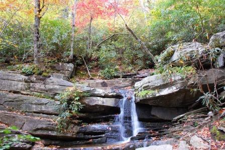
Hidden Falls, Hanging Rock State Park

Next, we backtracked through the park's main gate to visit Lower Cascade, located off Hall Road. The ranger's claim that it was the prettiest in the park was no understatement. But it is called Lower Cascade for a reason, and we walked down several sections of wood and then stone steps. Though it was a workout to reach the cove, our persistence was rewarded with a breathtaking view of a foamy white cascade falling into a shallow pool of water beside a massive rock face.


Once again, we had the place to ourselves. We stayed for a while and then headed to our final stop--Tory's Den and Falls.

If you're hiking with children, I wouldn't recommend this waterfall. Not only is it difficult to see given the angle along the cliff behind trees, the trail ends at an bumpy boulder that slopes down to a drop off. This is the great outdoors, so there is no railing to break a visitor's fall. The path is narrow as well, so there isn't much room. 

This is still a great stop though, as the opposite side of the trail leads to Tory's Den, a cave of historical significance. As Samwise, Pippin, and Merry learned in Fellowship of the Ring, if one is hiding from someone, one ought not light a campfire. As the story goes, in 1778, a band of Tories learned this lesson after they raided the house of a Whig colonel. They escaped, but a campfire gave away their position. Today, you can walk in the cave, which is more like an alcove. Lighting conditions were difficult given the bright sun shining outside the cave and the darkness inside, but I managed to take one rather bright photo that caught it all.

Tory's Den
In addition to hiking trails and waterfalls, Hanging Rock State Park offer bridal and mountain-bike trails, rock climbing, fishing, rowboat and canoe rentals, and vacation cabins and camping, seasons and weather permitting. I'm told the place stays fulls, so book early.

Pilot Mountain Through New Eyes

A rustle sweeping through towering sassafras and oaks sounded like rain. I waited for drops to fall on the canopy of our tent. When the sound passed by like a Doppler wave, growing in intensity before fading out, I realized it was only the wind.

Several leaves fluttered against the side of our new home-away-from-home, and I listened to the sounds filling the night air at Pilot Mountain campground with interest. We'd visited the park a few years after moving to North Carolina, but then, the purpose was to explore another one of the Old North State's stunning and unique geological landmarks. But family research that began several months ago with an Ancestry DNA test set off a chain of discoveries that showed me how deep my Carolina roots actually ran. And one of those roots involved Pilot Mountain and the sprawling Yadkin Valley it overlooks.

Today, the Yadkin Valley is wine country and home to several state parks that protect unique landmarks. However, in the past, the Saura Nation that once dwelled nearby called the mountain Jomeokee--the Great Guide. In later years, the domed peak now known as Pilot Mountain served as a navigational landmark for settlers migrating to the Yadkin Valley from Pennsylvania via the Great Wagon Road.

Pilot Mountain, as Settlers Might Have Seen It
Settlers traveling down the Great Road in late 1751 or early 1752 included my 6th and 7th great grandparents. As my husband and I drove north one day during our camping trip, then later headed south, back to the campgrounds, I realized I was looking at the same view my ancestors would have seen over 260 years ago. And when I stood in the parking lot near the summit of Pilot Mountain, I gazed out at the Yadkin Valley knowing I was gazing into my own past.


It made our stay even more exceptional.

But my own personal Jomeokee was only part of the reason of this trip. We visited another, nearby destination during our stay as well, and I'd like to think my ancestors also saw that towering peak as they made their way down the Great Road. So next up: Hanging Rock State Park.


Chimney Rock State Park

You wind down a two-lane road trying to snatch glimpses of the mountainous terrain surrounding you. Ahead, a dome of granite, shaggy with brush, comes into view and below it, a placid lake reflects the sky and nearby trees. A portion of the scenic Hickory Nut Gorge, home to a lake with ties to Patrick Swayze, the Bat Cave, and a mountain that once started a revival.

Copyright 2013, KBuffaloe
Within this gorge, towering above a quaint town and boulder-strewn river is Chimney Rock, one of North Carolina's most popular destinations and one of its newest state parks. Here, visitors can hike to breathtaking and sometimes terrifying heights, visit Hickory Nut Falls, seen in Last of the Mohicans, or cross a footbridge to stand atop the unique geological formation that gave Chimney Rock its name.

During our visit this past autumn, we wound our way up the mountain beneath a canopy of squash- and pumpkin-colored leaves. After parking in slots along the road's summit, we walked to the gift shop and then headed up Chimney Rock's engineering marvel, an elevator constructed in the mountain. At the top, we entered a gift shop and a cafe, a trailhead of sorts to magnificent views and to the rock they call Chimney.

For those in the mood for more exercise, steps from the base lead to the upper level.


After enjoying the dazzling view from Chimney Rock, we stopped at the Opera Box, an overhang located in the wall of rock seen in the photo above. For those terrified of heights as, unfortunately, your blog host is, this can be a challenge, but the view includes Rumbling Bald, the mountain that sparked a revival (www.discoverlakelure.com/1311644.html) and beautiful Lake Lure, filming location for Dirty Dancing.

Panoramic view from the Opera Box. Copyright 2013 K Buffaloe


Well worth the effort

To my knowledge, the Bat Cave cannot be seen from this vantage point, but at Chimney Rock's base, you can step into the old moonshiners cave.


During our visit, the park was hosting a rock climbing event for the boys and girls club. For information on activities at Chimney Rock, such as scheduling group or rock-climbing events, go to www.chimneyrockpark.com/

For more information on the geology that created Chimney Rock and the Hickory Nut Gorge, read Exploring the Geology of the Carolinas (Stewart and Roberson, Chapel Hill Press).
 Note: Though Chimney Rock is now a state park, admission is still charged as it was when the park was privately owned. At the time of our visit, the trail to Hickory Nut Falls was closed and admission was reduced. We requested, and received, a AAA discount as well.

Morrow Mountain State Park

Like Landsford Canal State Park in SC and the NC Zoo, Morrow Mountain is one of those "far" places we put off visiting until we could spend the night in the area. But last week, I was craving a mountain hike, so we packed up and took a long drive.

Morrow Mountain is nestled in a curve along the western edge of the Uhwarrie Forest, separated from the forest by the Yadkin/Pee Dee Rivers. It's in the Piedmont where mountains shouldn't exist. But North Carolina has several "little mountains" as the host of Exploring North Carolina called them. Mountains outside of the mountain range. This is due to the fact that NC is made up of strips of land called terranes. In short, the foothills of the Blue Ridge was once the original edge of North America, but additional land masses collided into that edge, forming the Old North State, as seen here in this USGS image:

http://tapestry.usgs.gov/states/northcarolina.html

When things collide, one or both sides buckle, creating folds. Water eroded much of the land in these folds, but erosion-resistant rock remained in some places, leaving behind peaks such as Pilot, Medoc, and Morrow Mountain. Consequently, elevated views exist in the Piedmont.


That erosion-resistant rock is the second reason Morrow Mountain is special. It has (rather, it is) an abundance of rock, including ryolite, rock with grains so small, they're undetectable to the eye.


Natives such as the Pee Dee tribe hauled the resilient rock down the mountain to other locations where they converted the stone into arrowheads or tools. Evidence of that activity still exist throughout the park. In addition to the presence of an ancient quarry, chips and shards litter the mountain side, including the Mountain Loop Trail near a summit that offers a breathtaking view of Lake Tillery.

Morrow Mountain has fourteen trails, three of which are bridle, though hiking is permitted on each at the time of this writing. The trails range from .6 to 9 miles, and from easy to strenuous. A boat ramp is available for those who would like to boat along the Yadkin. Rowboats and canoes are available for rental, as are cabins. Check the park's website for fees and availability.

As we quickly learned, Morrow Mountain is worth the drive. For more information, go to www.ncparks.gov/Visit/parks/momo/main.php

Grandfather Mountain Part II: Geology

Okay, I have avoided this subject for as long as possible. Geology is often difficult to understand, but to really appreciate Grandfather Mountain, visitors must at least give the subject a cursory glance because Grandfather Mountain is geology. It's conglomerate rocks, outcroppings and rock that gives the appearance of having been melted (this isn't the technical term, but how I viewed it). And when I read about Grandfather Mountain and geology, I come upon phrases such as rift basins, crustal sheets. thrust faults and geological window.

Here's what the park has to say on the subject: www.grandfather.com/worldofwonder/geology/

I'll just say that Grandfather Mountain has some pretty neat rocks, and not just the promontories that contribute to the famous profile.

Copyright 2012 K. Buffaloe
Shortly after entering the park, vistors approached two large boulders, commonly referred to as Split Rock and Sphinx Rock. Both are conglomerate rock which, according to Exploring the Geology of the Carolinas, is formed from various rock types including flattened pebbles. Significant in that it shows the rock has been metamorphosed (changed by heat and pressure).

Copyright 2012 K. Buffaloe
Larger than they appear!

Copyright 2012 K. Buffaloe
Closeup of the pebbles and rock that form these boulders:

Copyright 2012 K. Buffaloe
The rock at the Swinging Bridge is also conglomerate rock, but appears melted in some places, angular in others, providing dramatic, dynamic views.

Copyright 2012 K. Buffaloe


Copyright 2012 K. Buffaloe


Copyright 2012 K. Buffaloe

Copyright 2012 K. Buffaloe
And of course:

Copyright 2012 K. Buffaloe
So while admiring the incredible views from Grandfather Mountain, don't forget to examing the geological significant rock beneath your feet.

For more information, check out the chapter on Grandfather Mountain in Exploring the Geology of the Carolinas by Kevin G. Steward and Mary-Russell Roberson.

Grandfather Mountain Part I: The Summit

For some, the mention of Grandfather Mountain calls to mind the Mile-High Bridge, the animal habitat, and an imposing granite profile perched atop a mountain. Others know the mountain more for its history or geology. Whatever the interest, Grandfather Mountain is a state treasure, and one of North Carolina's newest state parks.

We recently traveled to Boone, NC to visit Grandfather Mountain. One of two destinations along the Blue Ridge Parkway we've passed far too many times, though not for lack of interest. Shortly after moving to the Carolinas, one look at the iconic photo of a man standing near the precipice overlooking a sea of white clouds, and then reading about the mountain in connection with the infamous Union guerrilla, Keith Blaylock, convinced me to visit. But between my fear of heights and an entrance fee, we shoved Grandfather Mountain to the bottom of the To-See list. After all, I could never cross that bridge, so why bother paying the price?

As I learned, for several reasons.

We began our visit at the entrance on US 221. After paying the entry fee, a bit less than we expected thanks to a AAA discount, we received a brochure and an audio CD that, with amazing timing, guided us up the road to the top of the mountain. We paid close attention, noting what we would return to, and where we would stop during our ascent (more on that later). But our main goal was the peak that for so many years, I longed to visit.

Our drive ended in the parking lot of the Top Shop, where a blast of cold wind curled around us and nearly knocked us off our feet as we stepped out of the car. The weather is unpredictable at the summit, so much so, weather equipment is attached to the bridge, so bring a warm jacket regardless of the season. Inside Top Shop, a gift shop and gateway to the Mile-High Bridge and that famous peak, I purchased a warm knit cap and we took the elevator to the upper deck where an inspiring view captivated me.

Copyright 2012 K Buffaloe
It was inspiring, I crossed that bridge despite my fear. I had to. It called me to, asking how could I come that far and not walk to that peak?

It helped that the bridge spans an 80-foot gorge, not a mile of empty space. The bridge is simply a mile above sea level. As we soon discovered, in the middle of the bridge near the mile marker, the wind whistles through the metal slats resulting in an ethereal song heard only by those who dare to cross. On this day, that would be me.

Why did the chicken cross the road? To see the view from the other side!
But the singing bridge and panoramic view wasn't all there was to see. As I mentioned earlier, Grandfather Mountain has a unique geology, easily visible to guests, which I'll discuss in my next post.

For more information on Grandfather Mountain, go to http://www.grandfather.com/

For a current view of Grandfather Mountain, check out the High Country Webcam:
http://www.highcountrywebcams.com/webcameras_grandfather.htm

Cliffs of the Neuse

A sunny day with a seventy-percent chance it would stay that way, so we traveled to Cliffs of the Neuse State Park (click here to read my original post on this NC destination) where we once again hiked the moderate Spanish Moss Trail. Eastern North Carolina is just waking from her dormancy, so we found only violets and an abundance of Carolina Jasmine in bloom.


And a tree putting on a spring show:

All photos copyright 2012 K Buffaloe

At the time of this writing, the lake was closed for swimming. For information on seasons and times, call the park office or check the website at www.ncparks.gov

Autumn at Merchants Millpond

We recently returned to Merchants Millpond State Park to hike, and enjoy what we knew would be gorgeous scenery. This is our second visit to the park, so I won't recap information posted in my first post.

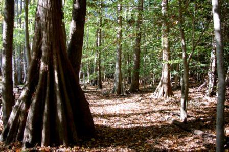
So I'll leave you with photos that we took near the picnic area we visited during our last visit, and also along the Cypress Point Trail.


A beautiful autumn day at one of North Carolina's beautiful state parks.

Mt. Mitchell State Park

Mt. Mitchell is the highest point east of the Mississippi. Part of the Black Mountains near Asheville, NC, Mt. Mitchell soars 6,684 feet above sea level. Not as high as mountains out west, but it's lush and cool, and it's the place to go to get a near 360 degree view of the surrounding Blue Ridge Mountains.

So it was our first stop on this visit to the Blue Ridge Parkway. Now part of a state park, Mt. Mitchell is located just off the Parkway between mileposts 355 and 358. Several years ago, the park tore down the old observation tower (which I often referred to as The Tower of Terror) and built a new platform. This, and a hike down the .75 Balsam Trail, just off the pathway to the summit, was our goal.

The threat of thunderstorms storms eliminated the hike, but we headed to the summit in the hopes of finding skies clear enough for a spectacular view. We got it, but unfortunately, our camera lens is broken, so we had to take photos with the zoom lens and our camera phones. Consequently, we couldn't capture the panoramic vista visible from the top of the platform.

Observation platform from Hwy 128


View from the paved path that leads to the summit:


Observation platform:


Atop the platform:


The platform is great. The view, stunning. I left with only one concern.

Mt. Mitchell is named after Rev. Elisha Mitchell, who correctly determined the mountain's standing as highest peak in the east. Shortly after, Senator Thomas Clingman claimed a nearby peak was higher. While in the mountains to confirm his measurements and put the dispute to rest, Rev. Mitchell lost his life after falling over a waterfall. (Honest. I did not make that up to emphasize last week's Waterfall Warning post!)

Rev. Mitchell is buried at the summit, beside the observation platform. A fence once protected his grave, but now, a low, stone wall filled with rocks surrounds the monument. During our visit, children sat and climbed on the wall, munching on tofu and crackers. When I voiced my concern over the change to the gravesite, they jumped up and away. They didn't have a clue.

I miss the fence.


Because of the altitude and a never ending breeze, Mt. Mitchell is usually a bit chilly, so bring a jacket. If you forget one, you can purchase a jacket or sweatshirt at the Visitors Center located at the parking lot below the summit, or at the restaurant you'll pass on the way to the peak.

Either way, stop at the restaurant and try their hot peach cobbler. It's the best I've tasted, and when I mentioned that to the woman at the cash register, she smiled. As it turns out, it was her grandmother's recipe. "She called it her Depression Cobbler," we were told. During the Depression era, sugar was difficult to obtain, so women like this dear lady's grandmother had to come up with alternate methods, such as cane and sorghum, for sweetening the treat. Her ingenuity lives on today.

On a final note, Mt Mitchell offers several hiking trails, ranging from easy to strenuous. For more information, see the park map at http://ncparks.gov/Visit/parks/momi/pics/parkmap.pdf.