It was our first trip to Swansboro, and found the little fishing village both charming and inviting. As an added plus, it's located near Hammock's Beach State Park.


A personal glimpse of outdoor destinations in and around the Carolinas. All photos and content copyrighted.


Until the last few months of the Civil War, Ft. Fisher kept North Carolina's port of Wilmington open to blockade-runners supplying necessary goods to Confederate armies inland. By 1865, the supply line through Wilmington was the last remaining supply route open to Robert E. Lee's Army of Northern Virginia. When Ft. Fisher fell after a massive Federal amphibious assault on January 15, 1865, its defeat helped seal the fate of the Confederacy.Inside the Visitors Center are numerous displays, photos, and even a fiber-optic battle map recreating the heroic efforts to (from the Confederate standpoint) keep the supply line open so they could end the d*#n war, or (from the Union perspective) take the fort, cut off supplies, and end the d#*n war.
www.nchistoricsites.org/fisher/fisher.htm


 Cape Lookout National Seashore and Shackleford Banks form a check-mark at the bottom of the string of barrier islands known as the Outer Banks. After paying the $15 per person (read the rest of this post before you dismiss that as being too costly for such an outing), we climbed aboard the ferry and began our journey across the Core Sound.
 According to Lighthouses of the Carolinas, the present Cape Lookout Lighthouse was built in 1859, and the original keepers had to lug heavy containers of oil 163 feet up to keep the light burning.
 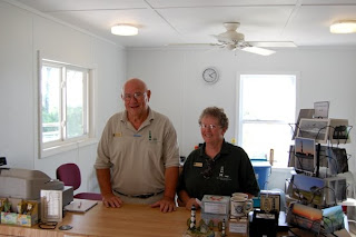 |
| Mack and Alice at Cape Lookout's Visitors Center |
 |
| Copyright K Buffaloe |

 |
| Copyright K Buffaloe |
 |
| Copyright K Buffaloe |
 |
| Copyright K Buffaloe |
 Opened in 1938, the restaurant sits on the waterfront overlooking Bogue Sound (if I'm reading it correctly, my Gazetteer indicates it's Money Island Bay.) Bits of framed history paper the walls, and we took in what we could as we followed the hostess over the glistening planked floor to a seat beside the window. Yes!
As the book indicated we would, we enjoyed a good meal for a good price, though because I can't eat fried foods, I ordered grilled chicken. Either the owner reads this blog and recognized us, or he firmly believes in providing customers with a quality experience--I believe the latter--because he stated such in a conversation we overheard.
You can bet we'll stop here more often.
Like most things in Morehead City, the restaurant overlooks the water. One can view it while dining, or while strolling along the boardwalk we spotted behind the eatery:
 As I've mentioned in the past, it's often difficult to get a pulse on the local culture during an initial scouting trip. As I once told NC native and poet, Julie Buffaloe Yoder, until we're familiar with an area, I can "get the basic recipe, but I lack the secret ingredients that make the dish savory". Julie's poetry gives me a deep, vivid look into the soul of many Downeasterners, so I turned to another native skilled with a pen for insight into Morehead City. After sharing a bit about the history, Sarah Salter told me:
The Morehead culture is one of hard work, dedication, deep love and loyalty. Those folks are the salt of the earth. Literally. They have salt water in their veins. A lot of that is reflected in their language, their laughter, and their zest for life.
She went on to tell of the transformation from a predominantly fishing village, to one heavily reliant on tourism. No surprise there, since the entire NC coast is a favorite tourist destination. Nevertheless, fish and water are still the lifeblood of this town. In addition to serving as a state port, sport fishing and boating are popular activities. Their annual seafood festival is quite popular, and along the paved waterfront is a marina where one can charter a boat to fish or take a day cruise:


The waterfront also has a nice selection of shops, including at least one bookstore. If you haven't noticed, we love bookstores. Local shops are the best because they tend to carry regional books not available at chain stores; items one wouldn't know existed to search for on Amazon. I've picked up half a bookshelf worth of publications during our trips, and on this outing, I found Island Born and Bred: A Collection of Harkers Island Food, Fun, Fact and Fiction. I may toss the recipes (I so don't cook) but I'll definitely keep the pages of hand drawn maps, recollections, poems, and information provided by Harkers Island Natives. I'd love to quote a few lines from a page I randomly chose while typing this, but I best get permission first. No sense being a copyright hound only to break the law myself.
In short, Morehead City is a great place to stop if you're in, or passing through the area, especially since it's conveniently located near Bogue Banks and Beaufort. We'll definitely go back to check out that half-day cruise. We've yet to explore the Carolina waterways, and it's time to rectify that mistake. And if my husband can find the tangle of fishing poles I stored somewhere so we can do some decent fishing, we'll run down to Morehead City to see what options are available there.
Until then, for more information on Morehead City, go to www.downtownmoreheadcity.com/
For more information on the good restaurant with the funny name, go to www.sanitaryfishmarket.com/
Twenty miles long, Bogue Bank is a pencil of an island south of Croatan National Forest. As a barrier island, its job is to protect the raggedy NC coast from Morehead City to the White Oak River Basin, but as it turns out, it's a great outdoor destination.
 From the mainland, we crossed the B. Cameron Langston Bridge (Hwy 58) near Cape Carteret, and immediately went to the Bogue Inlet Fishing Pier located on Bogue Inlet Dr in Emerald Isle. The pier is free if you just want to stroll along and admire the view of roiling turquoise waters skimming brown-sugary sand. If you want to fish, stop at the entrance and check out the fees (link is above.) Restrooms are available in the little store that serves as the entrance, and a restaurant opened during the high season is next door.
After walking to the observation tower and watching a few people pull in some nice catches, we headed back to the car and resumed our journey.
With large gift shops displaying beach towels and flip-flops in their windows, Emerald Isle appears to be a typical coast town. But it's clean and the main drag is nice and wide. We continued northward on that road toward Indian Beach and Salter Path. These communities are well developed, but according to the author of exploring north carolina's natural areas, which we brought along, the area is a mix of preservation and development. A thick maritime forest and shrub thickets can be seen throughout the island. In some places, homes have been built within the forest. Many times, we saw only the tips of rooftops and breaks in the trees indicating a driveway exists there.
We drove past those cities toward Pine Knolls, home of the North Carolina Aquarium. We didn't visit on this occasion, but it's on our short list of places to go. Also in Pine Knolls at the aquarium: the Theodore Roosevelt State Natural Area and Nature Trails. According to exploring, the Alice Hoffman Trail is less than a mile and is accessible from inside the aquarium. The second trail, the Theodore Roosevelt Trail is over a mile. Check hours and accessibility before you take small children, strollers, or wheelchairs. Since this is part of the aquarium, I expect one has to pay an admission fee to enter the trails. An attempt to call during this writing failed--the office is apparently closed on Saturdays, so call in advance. I'll update this post as soon as I confirm the information.
Also in Pine Knolls, the Hoop Pole Creek Nature Trail, which winds through maritime forest and marshes. The book states the trailhead is across the street from Hardees. It is, but it's across the small side street, not the main thoroughfare.
I was hungry by this time, but low season has begun along the NC coast which means many of the restaurants are closed, at least during lunch. Fortunately, the 4 Corners Diner, located at 100 E Fort Macon Road in Atlantic Beach, was open. I'm fairly picky when it comes to restaurants, and though the interior has a diner look to it, it's clean, has plenty of seating, and has good food for a decent price. I ordered a crab cake sandwich with a side of fries and a badly needed iced-tea, and my husband ordered breakfast, which is served all day. This will be a return stop on our next visit. Many thanks to them for allowing me to charge my camera battery while we ate (without my mentioning I planned to include them in this report!) Our last stop on this journey was a place I learned about shortly before we began our trip: Fort Macon State Park, located at the northern tip of Bogue Banks. We were shocked to see that Fort Macon really is a fort, and a rather sturdy one at that. Barely visible from the road, the old pentagon structure built in 1826 is below ground and has quite a history. I found the following on the North Carolina Division of Parks site:
Construction of the present fort began in 1826. The fort was garrisoned in 1834. In the 1840s, a system of erosion control was initially engineered by Robert E. Lee...At the beginning of the Civil War, North Carolina seized the fort from Union forces. The fort was later attacked in 1862, and it fell back into Union hands. For the duration of the war, the fort was a coaling station for navy ships.

