Pages

Showing posts with label Outer Banks. Show all posts

Pea Island National Wildlife Refuge

Most people think of the Outer Banks as a vacation spot, so many may be surprised to learn portions of the OBX are national wildlife refuges. Currituck NWR is located at the tip of the barrier chain, and in the middle, between Oregon Inlet and Rodanthe, you'll find Pea Island National Wildlife Refuge. This was our destination a few weeks ago, and you may wonder why given the cold snap North Carolina has been experiencing.

Because it's a great place to see wintering waterfowl!

After donning heavy coats, hats, and gloves, we grabbed our gear and set out on the three-hour drive. One travel option would have been the ferry from Swanquarter to Ocracoke (which would have allowed us to view even more waterfowl), but that particular route comes with a fee, so we traveled east on Highway 64. When we reached Hwy 12 on the OBX, like the birds we sought, we headed south.

From a past attempt to visit the refuge, I knew the visitor's center was located on the right side of the road, just a short distance south of the bridge spanning the Oregon Inlet. It was our first stop, and proved to be our best, for inside we met the Moores, who serve as volunteers for Pea Island. When we walked through the door, they greeted us with voices as warm as the interior of the spacious lobby/gift store, and we spent the next half hour or so talking, listening, and searching for birds they pointed out in the marshy areas of North Pond, located on the sound side of the OBX, through spotting scopes.

During our conversation, I mentioned our ultimate goal for this trip—to find the snow geese that had managed to elude us. With a smile, Neal Moore made us an offer we couldn't refuse: a guided tour to South Pond, just down the road from the visitor's center. By now I'm sure you know what we found:


Snow geese! And of course, Tundra swans:


It wasn't the thousands we'd heard about, but I wasn't complaining. When my fingers could no longer stand the brisk upper-20 temps, we headed back to the visitor's center, where we attempted to walk the North Pond Wildlife Trail, one of the many Charles Kuralt trails we've encountered in eastern NC. I had my eye on an observation platform visible from the visitor's center, and we hit the boardwalk, passing under a low canopy of tangled tree branches before cold air turned us around:


I later learned there are two trails at the refuge. The North Pond Trail, and Salt Flats, on the northern tip of North Pond. Pea Island is an excellent birding area, and the refuge has accommodated visitors while providing shelter for birds who need rest during their long journey south.

Pea Island NWR has over 5,800 acres (not counting water) on a stretch of land twelve miles long. In addition to playing host to migrating waterfowl, Pea Island sees its share of nesting sea turtles in the spring and summer. Oddly, it's also home to the Oriental, a steamer that sank off the shores of the OBX in 1862. Another gentleman at the visitor's center pointed us to a brochure that tells the story of the ship that fell prey to North Carolina's Graveyard of the Atlantic, and invited us to cross the street and traverse the dune to see the boiler which is still visible in the choppy waters. We declined on this trip, but as always, we have an excuse to return.

For more information on Pea Island, go to www.fws.gov/peaisland/ And if you're heading that way, don't forget to take your camera, binoculars, and plenty of warm clothes. A thermos of hot apple cider wouldn't hurt, either.

Our thanks to the Moores, especially Neal Moore, for serving as our guide on this trip.

Currituck Banks and Jockey's Ridge State Park

For the past year, we've been exploring eastern NC from the Fall Zone to the shores just off the Outer Banks. We've learned quite a bit during our outings. However, drawing on a quote I once read (the author of which I cannot remember) we've been jumping from parapet to parapet, and after a year of this, it was time to slow down and explore the castle's nooks and crannies.

We recently attempted to do that with a trip to Currituck Banks. It's a three and a half hour drive for us, so to maximize our time, we drove up on a Thursday evening and spent the night in Kitty Hawk. Depending on the hotel, the rates are fabulous on the Outer Banks right now, and we snagged a room for less than seventy dollars using our AAA discount.

The goal for this trip: explore Currituck National Wildlife Refuge and see the wild horses that roam the northern tip of the Outer Banks. Easier said. Hwy 12 ends at a beach, which is the entrance for the refuge. I presumed the sand would be packed down because this is the only way into the refuge and people have been driving on it for years.

Wrong. The sand is soft and deeply rutted, and after dishing out over a hundred dollars to fix our four wheel drive after the Mattamuskeet incident, Kelley was a bit nervous about attempting an off-road expedition. We gave it a shot, though. But when the ruts got deeper (and without our CarolinasAdventure posse there to push if we got stuck) we turned around.

The good news: various tours are available. I'd checked out the Jeep tours but they were too expensive for our current budget. Kayaking, and guided van tours are also available. This place is worth exploring, so we intend to return in the spring and take one of those tours.

Once back on paved ground, we stopped at the Currituck Banks National Estuarine Research Reserve, located within a few steps of the refuge's beach entrance. I'd read about this place in The Natural Traveler: Along North Carolina's Coast and knew we'd find a .33 mile boardwalk through the maritime forest that grows along the Outer Banks. Not what we had in mind but it would do.

To our delight, halfway down the boardwalk we found a mile and a half (round trip) nature trail that leads into a forest consisting predominantly of wax myrtle and live oaks, transitioning to pine near the water. The live oaks in this forest are amazing. Long, thin arms rest their elbows on the ground and then twist imploringly into the sky. The trunked sculptures stretched outward throughout the woods, pushing back other trees and providing space that allowed the winter light to shine through.

Blue blazes mark the trail. Note, we believe at least one sign is missing at a turn, and it gets a bit confusing in this area. If this happens to you, stop or backtrack if you can and look carefully. You should spot the blue-tipped stick a bit further down the path.

While enjoying the walk through the quiet forest, we came upon a pile of horse excrement. This often happens along a trail so I didn't think anything of it. By the forth pile, I finally caught on. Be still my Carolina heart, the wild horses roam through that area! Unfortunately, we didn't see any while hiking, or at the end of the trail where it meets Currituck Sound, but we saw plenty of evidence of their existence in that area.

After finishing that trail, we continued down the boardwalk to the observation platform overlooking marshes, Currituck Sound, and Monkey Island. The Estuarine is a good example of several types of natural environments: maritime forest, transitional forest, swamp, and marsh. From Natural Traveler, I learned North Carolina has four types of marshes: freshwater, brackish water, high saltwater and low saltwater. The marsh of Currituck Sound is an example of a low marsh, which floods daily with the tides. No wonder it's a research area!

Next, we made a quick stop at Currituck Lighthouse, situated in historic Corolla Village. After moving to ENC, I learned the four lighthouses of the OBX are similar in design, down to the wood and stone pilings they're built on. They're painted with different patterns so approaching mariners could distinguish one from the other. The Lighthouse Board left Currituck au naturale. The theory is this was to avoid having to paint it in the future. It was a good decision. Though built in 1875, Currituck is an attractive structure.

With time on our hands after not exploring the refuge, we made an unexpected stop at Jockey's Ridge, located in Nags Head. With its desert ambiance, tall dunes, wildlife that often roams the sand, and sparse vegetation, this destination deserves its own blog post. But more research and another visit is needed before I can attempt that. For now, I'll say that though around four hundred and twenty acres, the park is larger than I expected. Kelley hiked on while I stopped and took pictures, and at times, he was a speck atop the sand. Can you spot him in this photo?

At the top of that ridge, we were treated to a breathtaking view of a shaft of sunlight slicing across Currituck Sound. That view along with the 360 perspective makes the effort worth the climb. This being the highest spot, I assume it's also used for hang gliding and sandboarding, which are permissible under certain circumstances. The park has a hang gliding school, but I'll save that for the next post.

There are two "trails" at Jockey's Ridge: the one-mile Soundside Natural Trail, and the one-and-a-half mile Tracks in the Sand. But with all that sand, it's hard to tell exactly where the path is. We simply walked toward our destination.

As an added bonus, Jockey's Ridge runs perpendicular to the path of the sun and the shifting shadows along the dunes would make for some interesting photography in the early morning or late in the afternoon. Yes, we're definitely going back.

All in all a decent day despite not seeing the Outer Bank ponies.

So whether you're looking for a vacation spot or a nice getaway, the northern tip of the Outer Banks around Nags Head and Corolla is a great place to go. There's much to see and in the low season, hotel prices can be quite reasonable. Hope to see you there.

Then and Now: A Cosmic View of NC's Coast

In addition to his waterfall and wildflower books, North Carolina author and photographer, Kevin Adams, has compiled a photo treasure for lovers of all things Carolina. In North Carolina, Then & Now Mr. Adams presents two views of various areas around the Tar Heel State--one from the past and one from the present--by duplicating the location and angle of subjects in numerous old photos. That concept led to the following.

Thanks to my dear husband who read my Christmas list, I recently added The Natural Traveler: Along North Carolina's Coast to my outdoor reference library. It's a fantastic book, one I regret not purchasing earlier this year. I learned more about NC's estuary system from the pages I read than I had in the previous year surfing the net and reading material on my bookshelve. I also learned something that should have been old news--during a 1969 Apollo mission, an astronaut took a picture of North Carolina's coast. Upon reading that nugget, I surfed to Nasa's image library and using their download feature, downloaded the following:


Lake Mattamuskeet is clearly visible just to the left of the center of the photo and above that, the Alligator River and the Albemarle Sound. Knowing hurricanes and other factors have altered the OBX, I wondered how this photo compared to the view today, and then realized I have the ability to find out. Switching to http://www.mappoint.com/, I captured this screenshot:


The angle is a bit different but you can still see the same features. Interestingly, Lake Mattamuskeet is shaped differently, as is the upper curve of the Outer Banks. Zooming in, it's clear a few of the inlets remain the same, but from what it appears (and I could be wrong) the older photo shows more more breaks in the banks.

Viewing the coast from the heavens--and from the past--and comparing it to the present perspective was fascinating. I'll have to add Mr. Adams' North Carolina Then & Now to my library.

I think we're going to need another bookshelf.

Bodie Island Lighthouse

Lighthouses of the Outer Banks is another subject I've been avoiding. Not because we haven't seen any--we've visited three of the structures since our arrival (four if you count the one we saw in the distance.) But when I sat down to pen a post, I realized I knew precious little about them besides the fact they're tall and they shine or shone light across the water to guide mariners home.

But there's more. The NC coast is known as the Graveyard of the Atlantic and there are several lighthouses stationed along the Outer Banks and on the Crystal Coast. This led to several questions. What made the waters so dangerous and was there a design to the placement of the lighthouses? As I researched, I found some of the answers and then uncovered answers to questions I hadn't thought to ask. I learned a bit about the source of the bright shaft of guiding light, and the purpose of the various patterns painted on the lighthouses along the Outer Banks. I read about light stations (small versions, usually on a platform), the effect erosion and OBX shifting has had on the lighthouses, and more.

Attempting to cover all that will take days and a lot of blog space, so I'll share what I can and give you resources for the rest.

Bodie Island Lighthouse

We didn't know Bodie (pronounced body) Island Lighthouse existed until we saw it a few miles south of where Hwy 64 meets Hwy 12 (the road that runs south along the OBX.) We've been twice and so far, it's one of our favorite lighthouses. Not because it's more attractive than the others--its beauty easily matches Hatteras--but because of it's location and the presence of marshes just behind it.

After turning onto the road that leads from Hwy 12 to the parking lot, we stopped and marveled at the sight before us. The lighthouse is located in a field just off the parking lot allowing the one hundred and fifty-plus foot structure to tower over its visitors. We spent several minutes taking photos, then meandered across the football-sized field to the lighthouse.

With its broad, horizontal black bands, Bodie is easily distinguishable from its coastal brethren--which authorities intended when they chose that design. What you see today is actually the third Bodie Island Lighthouse. The first had to be rebuilt almost as soon as it was finished due to structural deficiencies. The second was demolished when Union Forces visited the Outer Banks uninvited during the War Between the States. According to various sources, the third and thus far final Bodie Island Lighthouse was built shortly after 1872.

The small structure you see in the photo (in front of the lighthouse) was once used to store oil for the lamp that created Bodie's beam, but since its replacement, the original 1st-order Fresnel Lens that now lights the way, works on a photocell, the structure is empty. The lighthouse is opened to the public on occasion, but to my knowledge, only to look inside. Climbing the metal steps is not permitted.

That's okay with me.

As I mentioned earlier, a portion of the Outer Banks' estuary system is located behind the lighthouse. I walked along a boardwalk past tall grass, reading placards on plant life and nutria along the way, and stopped at an wooden observation platform. A large flock of white birds floated in the distance and I watched them until I was certain they had no intention of flying or coming closer so I could get a photo.


Migratory birds floating in the water off to the right of the photo

Bodie is in good shape, so it's a favored subject of photographers and painters. However, because of it's beauty and accessibility, it's difficult to take a photo of the lighthouse without capturing tourists as well. If you can't visit during low season or on a weekday in spring when your odds are better, have patience. On both trips, we managed a few shots sans tourist just by waiting.

The old lighthouse keepers house is also located on the premises, and serves as a Visitor's Center and a bookstore (which we frequent when we can. You did receive the Bodie Island notecard I sent, right??) For more information on Bodie Island Lighthouse, go to:

Carolinalights.com
National Park Service's Bodie Island webpage
Lighthouses of the Outer Banks

A book I purchased to study for this blog post is Lighthouses of the Carolinas: A Short History and Guide by Terrance Zepke.

So why the need for so many lighthouses along the coast? To learn about the Graveyard of the Atlantic, click HERE

Outer Banks: An Overview

I've been procrastinating.

For months now, I've put off sharing a destination we first visited in December of last year and again this past May. Part of my problem has been determining the scope of what I should discuss. Our first trip to the Outer Banks (henceforth referred to as the OBX) encompassed the outskirts of Nags Head to Salvo and the second, from Kitty Hawk to Ocracoke. That's a lot of ground to cover. A lot of dunes, concurrent views of sound and sea. A lot of natural habitats to explore, outdoor recreation to draw your attention to, and oh, well you get the picture. Though harrowingly narrow in some places, the OBX is a lot of everything.

So I didn't cover anything.

But the time has come, so, after twittling with words for a couple of days, I've decided--like so many of our trips--to take off and see where we end up.

The Outer Banks

It wasn't our intent last winter to visit this North Carolina treasure. Our original goal was Edenton and Roanoke Island, but on our way to the second stop, a sign informed us Nags Head was a mere twenty miles away. How could we pass it up? So passing up the many attractions awaiting us at the site of the famous Lost Colony, we drove to the eastern edge of the United States and turned right. And to our delight, we were on the Outer Banks.

I'd heard about the OBX, but I knew little beyond what people had told me, that it's a great outdoor destination. If you look at a map of North Carolina, it's the sharp edge, the lip liner if you will, along the NC coast that juts to a point before scooping back to the mainland. Since our visit, I've learned it's more than that and I feel wholly inadequate to cover this fragile ecosystem/tourist destination. You'll understand why as you read.

The chain of islands known as the OBX begins around the Virginia/NC border, but I'm having trouble determining where it ends. Some sources say Ocracoke. Others include as far south as Bogue Banks. Personally, I include the entire archipelago from the Virginia border to Shackleford Island since I cannot see a difference between the northern section and the southern. NC may revoke my citizenship for that, but sorry, it's all breathtakingly beautiful to me.

Once on the OBX, one of the first things that struck me was the width. Though 175 miles long according to Encyclopedia.com (another source says 200 mi, see dispute listed above), it's narrow, earning it the nickname "Ribbon of Sand". Encyclopedia.com places the width at one mile or less and indeed, in some places, we saw both sound and ocean in the same glance:


See the touch of water on the upper right of the photo?

Since our first visit, I've learned more about the OBX (though not nearly enough.) First from a PBS documentary titled Ribbon of Sand, and then from various sources such as my copy of Coastal North Carolina: Its Enchanting Islands, Towns, and Communities. Enough to form a decent overview. Unfortunately, it's complicated, but I'll try to explain.

Think of long, thin islands, stretched in a line and joined together by bridges in some places, and by ferries in others.1 On the west side lay wide sounds. On the east, the Atlantic Ocean, and along some of its edges, swirling sandbars (shoals) visible on satellite photos but not to approaching ships. Traveling down Hwy 12 alongside tall dunes and under a sphere of blue sky gives you a feeling of freedom. You open the car window and take in the breeze and the view of herons walking dapperly in shallow waters.

You reach Rodanthe (ro-danth-ee, yes of Nicholas Sparks fame), see dozens of three story beach houses and you want to stay, but you travel on to Hatteras where you're delighted by the spiral banded lighthouse stretching regally into the sky and by boats drizzling through the water. You sit on the beach, hidden from civilization by an undisturbed dune and lay back in the sand, releasing a sigh of contentment. After a ferry ride to Ocracoke, Blackbeard's headquarters and the place of his infamous demise, you dine on local seafood, listening to tales of the pirate's ghost and wonder why you ever competed in the rat race.

That's one side of the OBX. Another is the dynamic, fragile environment. The ever-shifting coastline that's slowly eroding from waves, hurricanes, and development, which forced conservators to move the Cape Hatteras Lighthouse further inland.

The OBX has an extensive estuary system and such, hosts migratory birds. But it's also home to thousands of people whose livelihoods depend on tourism. Because of its compact width, man and nature must live together, and often, the needs of one clashes with the other. This past summer, authorities closed off several areas along the OBX because endangered birds were nesting, thus endangering businesses already hurting from high gas prices.

Saving one's job versus putting a near extinct bird in the air. Tough call. One I couldn't make.

There's more. Oh so much more. But I hope this gives you an adequate glimpse of the Outer Banks, its fragility, and its must-see beauty. In my next post, I'll discuss the lighthouses we saw this past year. The rest I'll have to cover in posts as we're able to return for additional visits. But I doubt I'll master all things OBX, there's too much to learn.

But I'll try.

For now, if you'd like more information on the OBX, go to http://www.outerbanks.org/

Also, check out UNC's book, Ribbon of Sand.


Post Script:

If you decide to travel to the Outer Banks, for land's sake, read my post on the Ferry schedule before you go. It may keep you from getting stuck on Ocracoke Island overnight and spending the night with a few OBX ghosts!
1. Coastal North Carolina: Its Enchanting Islands, Towns, and Communities (Pineapple Press) Pg 1

OBX (Outer Banks) Ferry Schedule

For the Outer Banks ferry schedule, click here: Ferry Schedule

For reasons why you absolutely need to check that schedule before traveling to the Outer Banks, read below:

----------------

After driving from Nag's Head to Ocracoke and then having to turn and go home via the already visited Nag's Head because we missed the 5:00 PM Cedar Island ferry by three minutes (the next ferry would run at 10:00 PM) I feel the need to post a brief blurb about transportation along the OBX.

There is one highway on the OBX, and at places where that highway ends at the tip of a few islands, the ferry system begins. This isn't an optional mode of transportation; a way of amusing the kids while at the beach (oh look, Mommy, let's take the ferry!) it's the only way to island hop to certain destinations, and if you miss the ferry, you may be sunk.

Sorry, I couldn't resist.

If you're planning to travel to the Outer Banks this summer and you have to reach a destination at a specific time, check the Department of Transportation's Ferry Schedule before you go. The ride across the water will add a distinct OBX flavor to your journey, but running late by even a few minutes may ruin your plans if you miss the boat.

Edenton, NC--The Prettiest Small Town in the South

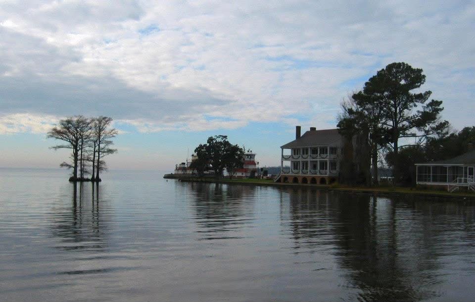
As boasts go, the people of Edenton, North Carolina have a good reason to claim their town is the prettiest small town in the south. Church bells pealing through quiet streets do little to disturb the sense of order created by stately or pastel-colored Federal, Victorian, Greek Revival, Georgian, and Jacobean style homes, neatly trimmed yards, and waterfront parks. With the grand architecture and rocking chairs idly waiting on long front porches, the historic district, situated on picturesque Edenton Bay, is so idyllic, so decidedly charming, visitors are tempted to quit their jobs and relocate just to get a slice of an era gone by.


The original residents were the Algonquian speaking Chowanac and Weapemeoc (don't ask me to pronounce that) Indians. Once settled by Europeans, it was called "The Towne of Queen Anne's Creek". Famous residents include signers of the Declaration of Independence and the U.S. Constitution. We didn't know any of that until we watched a 15-minute video at the Visitors Center where we loaded up on brochures. After we left, we drove to the waterfront and checked out what sites we could in the pouring rain. Fortunately, the majority of the neat stuff is in a three-block radius, and we found the waterfront, the Barker House, and the Cupola House before the rain forced us to leave.

We missed much, but we intend to return to take the walking and trolley tours, which will give us greater insight into the history and architecture of Edenton and provide additional exploration ideas. And with the proximity to the Dismal Swamp, the Albemarle-Pamlico peninsula with their pocosin lakes and state parks, and the hour and a half drive to Roanoke Island and the Outer Banks, Edenton is a perfect place to headquarter while visiting those attractions. As an added bonus (for us, not the people of Edenton) we're told low-season is very low in that city. As if to prove it, we encountered few tourists during our stay.

We'll most likely return in the spring when the dogwoods and azaleas are blooming, but before the tourists who have already discovered Edenton return. Knowing the city as I now do, I can almost picture the houses surrounded by a profusion of colorful blossoms, and it looks...well, perfect.